Established On: 9th February 1998
Population: 5,02,793 (as per 2011 Census), currently estimated to be around 0.65 million
Geographical Area: 118.18 Sq. Km
State: Maharashtra
District: Sangli
Geographical Background & Location: Sangli-Miraj-Kupwad is an urban agglomeration in Southern Maharashtra, located on the banks of the Krishna River. It lies in the Deccan Plateau and has a moderate climate with hot summers, pleasant winters, and monsoon rains from June to September. The city is well connected by road and rail, making it an important commercial and industrial hub.
History: Sangli has a rich history, dating back to the rule of the Marathas and later the British Raj. The city was part of the Sangli Princely State, ruled by the Patwardhan dynasty before merging into the Indian Union. Miraj is historically known as a cultural and medical hub, famous for its classical music tradition and as a major healthcare center in Maharashtra. Kupwad developed as an industrial zone, contributing significantly to the region’s economy.
Civic Administration & Development: The Sangli-Miraj-Kupwad City Municipal Corporation (SMKMC) was established in 1998 to oversee the urban development of these three interconnected cities. It is the largest municipal corporation in South Maharashtra and is responsible for providing essential services like:
- Road Infrastructure: Several well-planned, wide roads have been constructed to ease traffic congestion.
- Sanitation & Waste Management: The corporation has implemented innovative projects for cleanliness and garbage disposal.
- Water Supply & Drainage: Efforts have been made to ensure a consistent supply of clean water and maintain proper drainage systems.
- Smart City & Beautification Projects: SMKMC has undertaken multiple projects to enhance the city’s aesthetic appeal, including lake rejuvenation, park development, and street beautification.
- Slum Development & Housing: Several schemes have been implemented to improve living conditions in slum areas.
Economy & Industries: Sangli-Miraj-Kupwad is an emerging industrial and commercial hub. The major industries include:
- Turmeric Trading: Sangli is the largest turmeric market in Asia.
- Wine Industry: It is one of the leading grape and wine-producing regions in India.
- Medical Sector: Miraj is a renowned healthcare center, with numerous hospitals and medical institutions.
- Engineering & Manufacturing: Kupwad houses several small and medium-scale industries.
Tourist Attractions & Cultural Heritage:
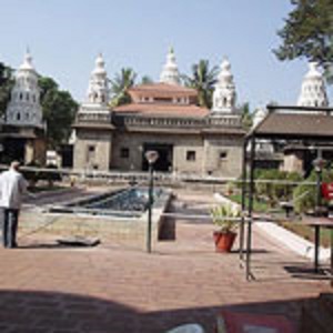
- Ganapati Temple, Sangli – A historic temple dedicated to Lord Ganesha, built by the Patwardhan rulers.
- Irwin Bridge – A beautiful old bridge over the Krishna River, offering picturesque views.
- Sangli Fort – A historic fort built during the Maratha era, showcasing ancient architecture.
- Dandoba Hill Forest Reserve – A scenic spot perfect for trekking and wildlife exploration.
- Miraj Musical Instruments Industry – World-famous for the production of high-quality Indian classical musical instruments, especially Tanpura and Sitar.
- Vishrambag Wada – A heritage site showcasing the architectural grandeur of the Peshwa era.
- Krishna Riverbank – A serene spot for leisure and religious activities.
Transportation & Connectivity:
- Road: The city is well connected to major cities like Pune, Mumbai, Kolhapur, and Bengaluru via NH-166 and NH-48.
- Railway: Miraj Junction is an important railway station in Maharashtra, serving as a key railway hub connecting Maharashtra to Karnataka and Goa.
- Airport: The nearest airport is Kolhapur Airport (50 km away), with Pune International Airport being the closest major airport.
GEOGRAPHICAL INFORMATION
| Temperature Range (Deg °c) | Maximum | Minimum |
|---|---|---|
| Summer | 430C | 38.50C |
| Winter | 250C | 12.80C |
| Latitude | 180 15 ' to 190 55' | |
| Longitude | 770' to 780 25' | |
| Climate | Tropical | |
| STD Code | 0233 |
MAIN ATTRACTIONS


